Hiking the Calanques of Port Miou, Port Pin and d’EN Vaut with kids
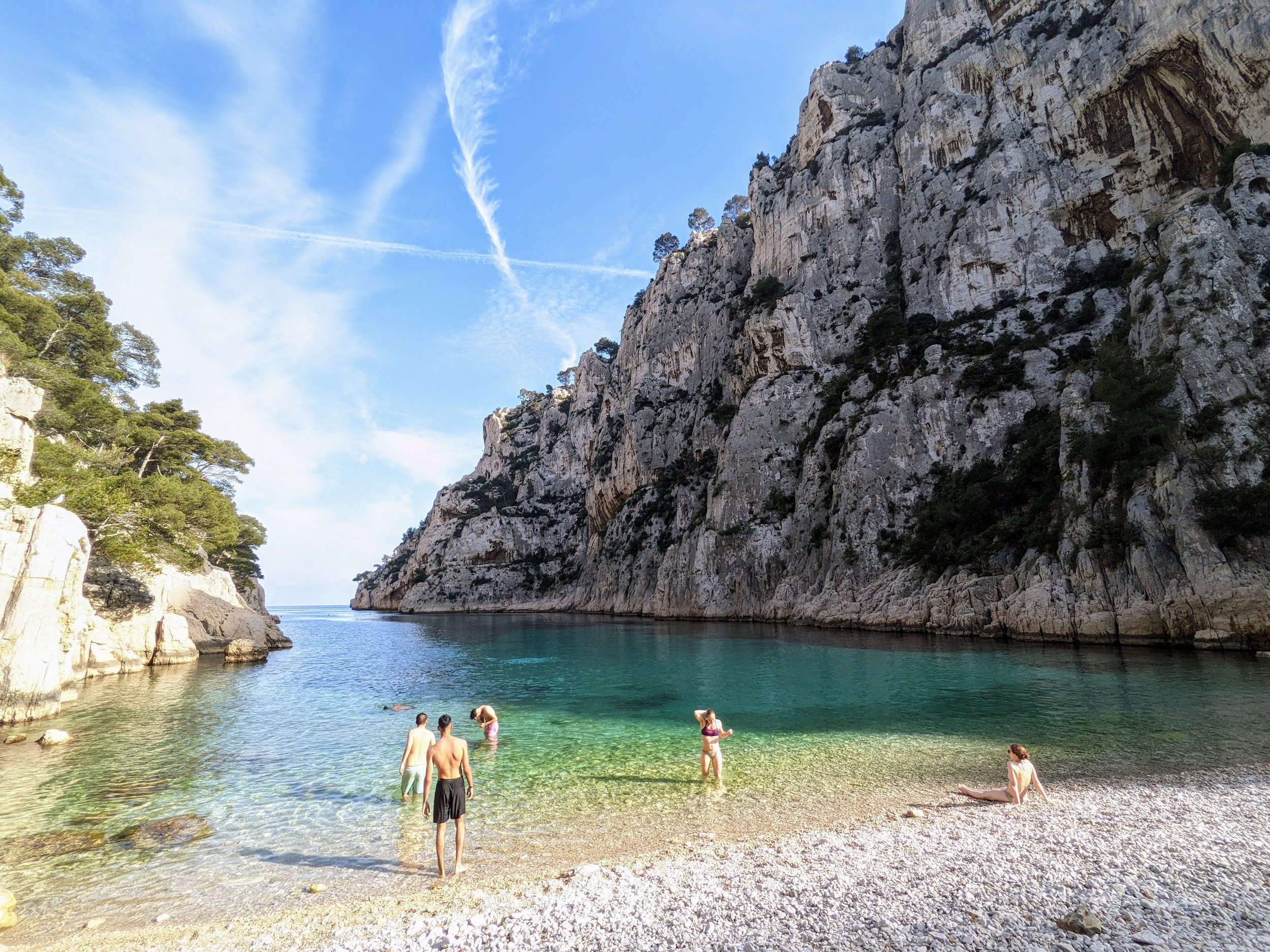
The beach at Port d’EN Vaut, near Cassis in the Calanques.
What are the Calanques?
The Massif des Calanques is a national park in southern France that stretches 20 km from Marseille to Cassis and extends 4 km inland from the rugged coast line. A Calanque is a “narrow, steep-walled inlet composed of limestone, dolomite, or other carbonate strata found along the Mediterranean coast.” The national park is crossed by multiple trails of varying difficulty. It only took a few images of the Calanques d’En Vaut to motivate me to check out one of the easier trails that begins in Port Miou, passes by Port Pin, along the cliffs of d’EN Vaut, and ends at the gorgeous Port d’EN Vaut. The landscape of the Calanques is truly spectacular with sheer white limestone cliffs surrounding calm, clear turquoise waters. The town of Cassis, where the trail begins, is also a picturesque example of a French Riviera fishing town with the towering cliffs of the Cap Canille, the highest sea cliff of France on one side and Calanques National Park on the other.
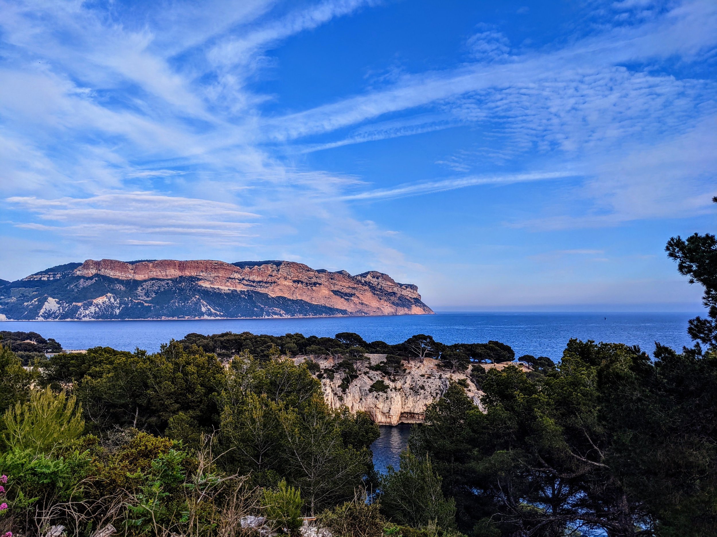
View of Cap Canille, the tallest sea cliff in France, from the trail back to Port Miou
Trailhead:
The trail begins at the end of Avenue des Calanques where there is a gravel parking lot just inland from Port Miou. When we visited on a Monday at 2:00 PM in May, the parking lot was closed. I still don’t know why and could not see any hours listed anywhere nearby. In short, you might be able to park at the trailhead, but I wouldn’t count on it. There is free street parking along the Avenue des Calanques and additional public parking on the other side of Port Miou and further into the town of Cassis. To avoid walking along the road with kids (which always stresses me out), Joey dropped us off and parked the car in about 10 minutes.

Started from Port Miou along the green 8, took the blue 4 to the left up to the cliffs, then the red 7 down to Port d’EN Vaut, then the Blue/Green/Red back to Port Moui. The red 7 down to Port d’en Vaut is the treacherous part.
Length:
4.8 miles
Trail type:
Lollipop trail with the loop portion beginning at Port Pin
Difficulty:
Moderate. Alltrails rates this trail as easy. I think that is a misleading rating. As a result, we saw several people wearing inappropriate shoes and struggling with the steep descent on loose gravel down into Port d’EN Vaut. Most agile kids ages 4 and above should be able to navigate the steeper sections without trouble, but I would not take anyone with balance issues on this hike.
Elevation change:
1,286 ft up and down.
Payout:
10/10 The landscape is truly spectacular here and it really does look like the pictures.

The sheer white limestones cliffs of the Calanques contrasting with the emerald green waters with the beach of Port d'EN Vaut in view
Facilities:
There are NO facilities on this trail or at the trailhead! This is a HUGE problem, as this is a highly used trail. Every time I left the main trail, I found piles of toilet paper and clear evidence of human waste. This really detracted from the beauty of the place. I highly recommend stopping for a bathroom break before starting this tail and avoiding using the bathroom in nature if possible. There is a small snack stand at the trailhead, but it was closed when we were there.

The Port Miou filled with boats stored for the slow season.
Following the trail:
We used the Alltrails app to follow this trail but it was well marked with signage and very well-travelled. The stick of the lollipop follows a wide dirt and gravel road alongside Port Miou, which is a harbor packed full of boats. There is some gradual elevation gain during this portion of the trail and great views of Cap Canille and Cassis across the port. At the end of the stick of the lollipop, the trail descends to Port Pin.

The Boys at Port Pin where the water was a glassy emerald blue and inviting except for the crowd.
Port Pin is a gorgeous beach located at the head of a deep calanque. The water is calm and clear and this looked like a lovely place to swim. The only downside is that it was quite crowded, despite us being there on a Monday in May. I wouldn’t count on having this “secluded” beach to yourself.

Note the sign at Port Pin has Port d’en Vaut in both directions. To the left is longer with more elevation change but incredible panaramic views of the Calanques. The right is a shorter and easier route to Port d’en Vaut
After you pass Port Pin on your left, you will have several options for how to proceed on to Port d’EN Vaut. We took the left fork which leads out to the cliff separating Port Pin and Port d’EN Vault. This part of the trail adds about 300 feet of elevation change and 1 mile to the hike but provides amazing views of the Port d’EN Vaut from above. The portion of the trail is rocky but well established and easy to follow.

Panarama from the top of the blue 4 trail to Port d’en Vaut that takes you along the precipice of Calanques d’en Vaut
Alternatively, at this point, you could take the right fork that leads straight to Port d’EN Vaut and bypasses the cliff view. This would be a reasonable route if you want a slightly less challenging hike.

The intersection of the blue 4 and red 7 trail where you head left to get to Port d'EN Vaut or right to go back to Port Miou. Cassis France
After making your way around the cliff (if you choose the route we took), you will come to a trail intersection. At this point, you will follow the signs to the left to head down into the Port d’EN Vaut. This portion of the trail is a steep descent into the canyon. The rocks are slick and well-worn by extensive human traffic over time and the bottom half of the descent is on a loose gravel path.

The smooth stones that are slick underfoot from years of hikers make the descent to the beach particularly dangerous
After stopping to enjoy the rocky beach, crystal clear water, and surrounding towering cliffs of Port d’EN Vaut, you will head back up the same path to leave the port. Once at the top, you will find yourself back at the same intersection. Here, you will take the left fork to finish the loop portion of the lollipop. This portion of the trail is a gradual descent back down to Port Pin. You will then re-trace the stick of the lollipop back to the trailhead.
What we liked about this trail:

Views from the long route along the cliffs to Port d'en Vaut
The views. It really is a spectacular landscape.
Port Pin and Port d’EN Vaut are both gorgeous places to swim. We even saw several fish while swimming around the cove of Port d’EN Vaut.
Length and difficulty. This was a nice moderate trail with enough activity to give us a work out but not too much difficulty.

Wendi and Gus enjoying the crystal clear emerald waters of Port d’EN Vaut.
What we did not like:
The evidence of human waste. I’m not talking trash here. I mean toilet paper, urine, and human feces in every small trail leading off the main path. The government REALLY needs to install pit toilets on the trail and people REALLY need to pack out their own waste. If you need to use toilet paper, bring a plastic bag to put the toilet paper in and carry it out with you! If you must defecate while doing this trail, use standard Leave-no-trace practices of digging a hole at least 4 inches wide and 6-8 inches deep. Use the bathroom in the hole, pack up any used toilet paper, and fill the hole in after usage. The only upside is that people do seem to make an attempt to get off the main trail, so, you could avoid seeing most of this by sticking to the path.
The trail is very popular and there were a lot of people on the trail and at the beaches, even on a weekday. I can’t imagine how crazy it is on the weekends and I would not hike this trail on the weekend.
The closed parking lot.

The empty parking lot closed in the middle of the day for an unknown reason.
Tips:
Use the bathroom before doing this hike and avoid going off trail.
Wear good close-toed hiking shoes. Since part of the trail includes a steep descent on loose gravel, sandals are not a good idea.
Pack snacks since there are minimal facilities here.
Bring a bathing suit to enjoy a swim at Port Pin or Port d’EN Vaut.
Do this hike on a weekday.
Skip the part of the loop out to the cliffs of Port d’EN Vaut for an easier route to the beach if you want a less challenging hike. While the views were great from above, the kids felt strongly that they weren’t worth the extra 300 feet of elevation and mile of hiking. They would have rather had more time at the beach.
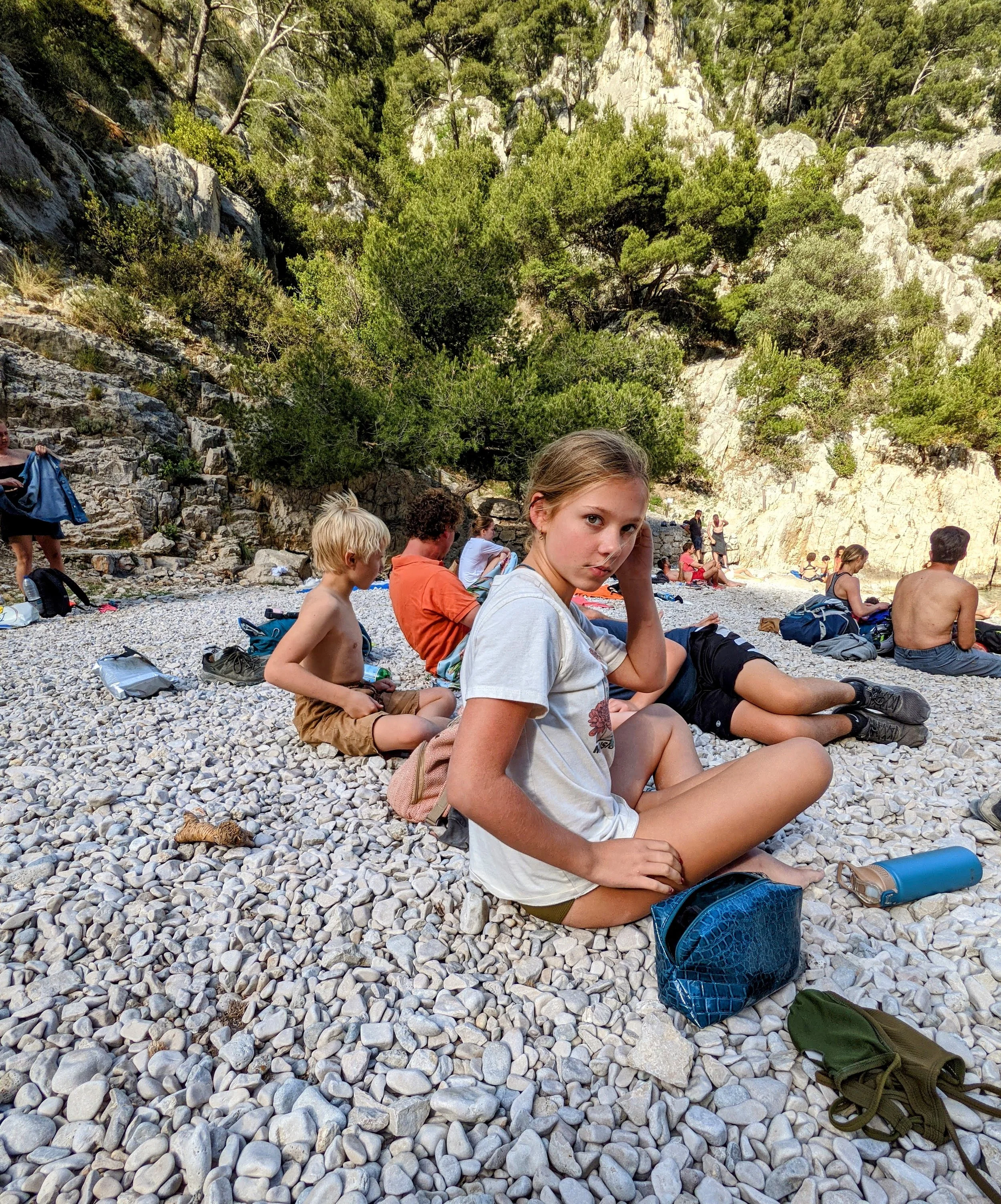
Chilling on the beach at Port d'EN Vaut. We have come to enjoy rocky beaches more than we expected.
Final thoughts:
This is a gorgeous and striking landscape that is worth adding to your southern France itinerary. With the tips above, this can be a great and memorable experience. Share your experiences with this trail or any other trails in the Calanques National Park in the comments below.

Headed back to the car with amazing views of Cassis and Cap Canille